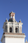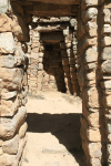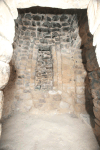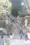
View of La Paz, with the high Andes in the background. (676k)
Here are some pictures from the Andes, the Altiplano, and Lake Titicaca.
The Andes are the site of the Qhapaq Ñan, Andean Road System, a UNESCO World Heritage Site. This Inca road system connected most of the Andes in the 15th century, covering some 30,000 km (19,000 miles).
All pictures are © Dr. Günther Eichhorn, unless otherwise noted.
From the Wikipedia entry for La Paz:
La Paz, officially known as Nuestra Señora de La Paz (English: Our Lady of Peace), also named Chuqi Yapu (Chuquiago) in Aymara, is the seat of government and the de facto national capital of the Plurinational State of Bolivia (the constitutional capital of Bolivia is Sucre). With an estimated 789,541 residents as of 2015, La Paz is the third-most populous city in Bolivia (after Santa Cruz de la Sierra and El Alto).
Its metropolitan area, which is formed by La Paz, El Alto and Viacha, makes up the most populous urban area in Bolivia, with a population of 2.3 million. It is also the capital of the La Paz Department.
The city, located in west-central Bolivia 68 km (42 miles) southeast of Lake Titicaca, is set in a canyon created by the Choqueyapu River. It is located in a bowl-like depression surrounded by the high mountains of the Altiplano. Overlooking the city is the towering, triple-peaked Illimani. Its peaks are always snow covered and can be seen from many parts of the city. At an elevation of roughly 3,650 m (11,980 ft) above sea level, La Paz is the highest capital city in the world. Due to its altitude, La Paz has an unusual subtropical highland climate, with rainy summers and dry winters.
La Paz was founded on October 20, 1548 by the Spanish conquistador Captain Alonso de Mendoza at the site of the Inca settlement of Laja as a connecting point between the commercial routes that led from Potosí and Oruro to Lima; the full name of the city was originally Nuestra Señora de La Paz (meaning Our Lady of Peace) in commemoration of the restoration of peace following the insurrection of Gonzalo Pizarro and fellow conquistadors against the first viceroy of Perú. The city was later moved to its present location in the valley of Chuquiago Marka. La Paz was under Spanish colonial rule as part of the Viceroyalty of the Río de la Plata, before Bolivia gained independence. Since its founding, the city was the site of numerous revolts. In 1781, the indigenous leader and independence activist Túpac Katari laid siege to the city for a total of six months, but was finally defeated. On July 16, 1809 the Bolivian patriot Pedro Domingo Murillo ignited a revolution for independence, marking the beginning of the Spanish American Wars of Independence, which gained the freedom of South American states in 1821.
El Alto (Spanish for "The Heights") is the second-largest city in Bolivia, located adjacent to La Paz in Pedro Domingo Murillo Province on the Altiplano highlands. El Alto is today one of Bolivia's fastest-growing urban centers, with a population of 974,754 in 2011. El Alto is the highest major metropolis in the world, with an average elevation of 4,150 m (13,620 ft). The city contains La Paz's El Alto International Airport.


From the Wikipedia entry for Altiplano:
Parts of Bolivia are in the high Andes. The Altiplano (Spanish for "high plain"), Andean Plateau or Bolivian Plateau, is the area where the Andes are the widest. It is the most extensive area of high plateau on Earth outside Tibet. The bulk of the Altiplano lies in Bolivia, but its northern parts lie in Perú, and its southern parts lie in Chile and Argentina.


From the Wikipedia entry for Lake Titicaca:
Lake Titicaca (Spanish: Lago Titicaca, Quechua: Titiqaqa Qucha) is a large, deep lake in the Andes on the border of Bolivia and Perú, often called the "highest navigable lake" in the world. By volume of water and by surface area, it is the largest lake in South America. Lake Maracaibo has a larger surface area, but it is a tidal bay, not a lake.
Lake Titicaca has a surface elevation of 3,812 m (12,507 ft). The "highest navigable lake" claim is generally considered to refer to commercial craft. For many years the largest vessel afloat on the lake was the 2,200-ton, 79 m (259 ft) SS Ollanta. Today the largest vessel is most likely the similarly sized train barge/float Manco Capac, operated by PeruRail. Numerous smaller bodies of water around the world are at higher elevations.
The lake is located at the northern end of the Altiplano basin high in the Andes on the border of Perú and Bolivia. The western part of the lake lies within the Puno Region of Perú, and the eastern side is located in the Bolivian La Paz Department.
The lake is composed of two nearly separate sub-basins connected by the Strait of Tiquina, which is 800 m (2,620 ft) across at the narrowest point. The larger sub-basin, Lago Grande (also called Lago Chucuito), has a mean depth of 135 m (443 ft) and a maximum depth of 284 m (932 ft). The smaller sub-basin, Wiñaymarka (also called Lago Pequeño, "little lake"), has a mean depth of 9 m (30 ft) and a maximum depth of 40 m (130 ft). The overall average depth of the lake is 107 m (351 ft).
Five major river systems feed into Lake Titicaca. In order of their relative flow volumes these are Ramis, Coata, Ilave, Huancané, and Suchez. More than twenty other smaller streams empty into Titicaca. The lake has 41 islands, some of which are densely populated.
Having only a single season of free circulation, the lake is monomictic, and water passes through Lago Huiñaimarca and flows out the single outlet at the Río Desaguadero, which then flows south through Bolivia to Lake Poopó. This only accounts for about 10% of the lake's water balance. Evapotranspiration, caused by strong winds and intense sunlight at high altitude, balances the remaining 90% of the water loss. It is nearly a closed lake.


The Inca Temple of the Sun on the Isla del Sol in Lake Titicaca dates back to the 14th century.


This page contains 38 pictures
Page last updated on Mon May 30 13:10:26 2022 (Mountain Standard Time)
La Paz, Lake Titicaca and the High Andes on gei.geichhorn.com